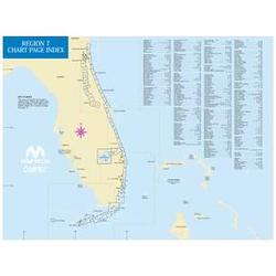
Maptech Paper Chart Kit Book Region 07 Florida East Coast

CHARTKIT Book w/ Companion CD Florida East Coast and the Keys St. Marys Entrance to Dry Tortugas, inside and outside, including St. Johns River, St. Lucie River and Lake Okeechobee. Full-color charts, waypoints, courses and distances, chart datums for GPS, Yeoman points, and aerial photos. 22 X 17 , 78 chart pages. Product Overview Used by generations of boaters, ChartKits are full-color reproductions of U.S. government and private charts spiral bound into popular cruising regions. The convenient-sized books are large enough to allow for manual plotting, yet small enough to sit on your nav-station or lap GPS Ready New features make ChartKits easy to use with your GPS. Most charts include one-minute lat./long. grids to make vessel positioning a breeze, and major navigation aids are identified with named GPS waypoints. Small and Large Scale Charts ChartKits include small-scale, wide area charts as well as large-scale, detailed charts of harbors and approaches. The Chart Page Index (inside front cover) and Go-To page numbers make it simple to quickly find the chart you want. Pre-Plotted Courses Maptech's navigation editors add magnetic courses between major navigation aids with distances in nautical miles. ChartKits are also designed to help you do the calculations yourself. Each page includes a Compass Rose with annual increase in variation and complete scale information. Aerial Photos Color aerial photos of harbors and anchorages help you know what to expect before you get there. Companion CD It's all here...digital charts and the software tools to use them. And the great thing is the digital charts are the same identical charts with GPS waypoints and course lines - just like in the Chartbooks. Plan Chartbook Companion CDs include Offshore Navigator Lite navigation software. Click your mouse to put a waypoint on a chart. Click again, and you're creating a route. It's that easy. Distances, bearings and GPS positions are calculated and displayed instantly. Print Print your own customized GPS waypoints, route plans and chart segments on color or black and white printers. GPS Positioning Rollover Connect a GPS to your laptop and see your real-time position on the computer screen. Real-time positioning requires connecting an industry-standard NMEA 0183 GPS to your PC.
Want to buy the Paper Chart Kit Book Region 07 Florida East Coast?
Click on our link above to get more product information. You can purchase the product at the best price and simultaneously assist this site, giving us the ability to hire more writers and expand our resources for entrepreneurs site.
Looking for more Software Geography Software products? Try the
Paper Chart Kit Book Region 08 Florida West Coast from Maptech. Another product to consider is the Maptech Paper Chart Kit Book Region 15 Pacific Northwest.
Didn't find exactly what you were looking for? Then, simply choose a product category from the Software directory below to find the Buy.com products you need,as well as take advantage of active coupon codes.
Software